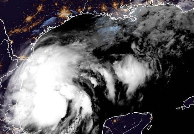
A tropical disturbance in the southwestern Gulf of Mexico was shaping up as what could be the season’s next hurricane, the National Hurricane Center said early Monday. It would be called Francine and end a brief lull that hurricane-prone regions were enjoying.
The hurricane center said the system is expected to become a tropical storm Monday and a hurricane before it makes landfall, likely over the northwestern U.S. Gulf shoreline Wednesday, bringing with it an “increasing risk of life-threatening storm surge and hurricane-force winds along the Louisiana and upper-Texas coasts.”
NOAA / National Hurricane Center
The system was expected to dump 4-8 inches of rain in many areas and up to a foot in some places, forecasters said.
Tropical-storm-force winds were extending outward up to 185 miles from the system’s center early Monday.
That center was about 295 miles south-southeast of the mouth of the Rio Grande and some 535 miles south of Cameron, Louisiana. It was crawling north-northwest at 5 mph.
The disturbance had maximum sustained winds of 50 mph, well above the 39 mph needed to be officially dubbed a tropical storm but, explains CBS senior weather and climate producer David Parkinson, its center wasn’t defined clearly enough yet to get that classification.
A Tropical Storm Watch was in effect for Barra del Tordo, Mexico to the mouth of the Rio Grande and from there to Port Mansfield, Texas.
The disturbance follows an unusually calm August and early September in the Atlantic hurricane season, which has had five named storms.
Experts had predicted one of the busiest Atlantic seasons ever and, The Associated Press notes, Colorado State University researchers said last week they still expect an above-normal season overall.
